Category 5 Hurricane Erin Prompts Coastal Evacuations Amid Shifting Forecast
Hurricane Erin intensifies to a dangerous Category 5, prompting mandatory evacuations for Carolina barrier islands and North Carolina's Outer Banks. Coastal flooding is expected.

 Boston Herald
Summer celebrations meet closed beaches and warnings on US East Coast due to Hurricane Erin

 NPR
NPRSwimmers are warned to avoid East Coast beaches as Hurricane Erin moves north

 The Guardian
Hurricane Erin pounds US east coast as residents brace for ‘life-threatening’ waves
 BBC News
Hurricane Erin: North Carolina braces for storm surges and coastal flooding
Overview
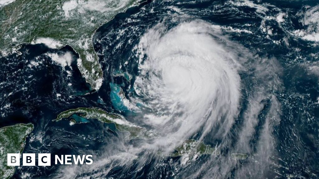
Hurricane Erin has intensified to a dangerous Category 5 storm, sustaining powerful winds of 140-160 mph, posing an extreme threat to coastal regions with potential for widespread damage.
Authorities have issued mandatory evacuation orders for residents on barrier islands along the Carolina shore and North Carolina's Outer Banks, anticipating a direct impact from the powerful hurricane.
Forecasters warn of dangerous rip currents, swamped roads, and waves up to 15 feet, with widespread coastal flooding expected from Tuesday through Thursday as the storm approaches.
Experts anticipate Hurricane Erin will turn north or northeast, moving away from the immediate eastern U.S. coastline, thereby reducing the direct landfalling risk for the mainland.
Hurricane Erin has already generated significant waves over 10 feet and sea swells of 8 to 12 feet in the Turks and Caicos Islands, prompting tropical storm warnings.
Analysis
Center-leaning sources cover the story neutrally by focusing on factual reporting of Hurricane Erin's trajectory, potential impacts, and official warnings. They prioritize public safety information and preparedness measures, presenting meteorological data and government advisories without injecting subjective interpretations or political angles, ensuring a clear and informative account for readers.